
My book, Historic Maps of Boston, is about how Boston became the city it is, and so much of that story is about land. Boston began as a small, hilly peninsula called Shawmut, connected to the mainland by a thin neck, and much of the city we walk today did not exist when it was founded. This historic Boston walking tour follows that story on foot, from the old waterfront to the newest land, and October is my favorite time to do it.
My book is here. It is a coffee-table book of maps of Boston and it came out on September 1. If you are curious about it, start with the walk below, then look at the maps.
Why Old Maps Change How You See Boston
The original peninsula covered roughly 789 acres. Over the next two centuries, Bostonians cut down hills, filled coves and mudflats and pushed the shoreline outward until the city grew far beyond its colonial outline. Lay an early map over a modern one and you realize that some of the most famous places in Boston were once underwater.
That is what makes a map such a good guide. It shows you where the edge used to be.
As I shared before the book came out, Historic Maps of Boston is an exploration of Boston’s history through the art of cartography.
Stop 1: Long Wharf and the Old Waterfront
Start at Long Wharf, at the foot of State Street. Built between 1710 and 1721, it originally ran about a third of a mile into the harbor so larger ships could dock. Since then the land around its base has been filled in, which is why the wharf now begins well inside the city. The granite Custom House Block, built on the wharf in 1848, still stands.
If you want to see the city from the water afterward, I recommend a harbor cruise with Classic Harbor Line. It is the best way to understand how much of the skyline sits on made land.

Stop 2: Old State House and Faneuil Hall
Walk up State Street to the Old State House, then over to Faneuil Hall. Both are Freedom Trail stops and both tell the landfill story. Faneuil Hall, completed in 1742, sits on land that was part of Town Cove until 1732. Quincy Market, just behind it, was built between 1824 and 1826 on more filled land.
The 1722 map by John Bonner, considered the oldest surviving printed map of Boston, shows the town still in its peninsular shape, lined with wharves and shipyards. Standing in Faneuil Hall Marketplace, it is remarkable to think the harbor once came almost to your feet.
Stop 3: Beacon Hill, the Hill That Shrank
From Faneuil Hall, walk up toward Beacon Hill. Boston once had three peaks here, which is where the early name Trimountain comes from. Between 1807 and 1832, Beacon Hill itself was cut down from about 138 feet to 80 feet. Much of that earth went into filling the Mill Pond to the north, creating what is now the Bulfinch Triangle near North Station, and into new land along Charles Street.
For your historic Boston walking tour, take your time here:
- The Massachusetts State House, designed by Charles Bulfinch and completed in 1798 on land that once belonged to John Hancock.
- Louisburg Square, with its Greek Revival townhouses.
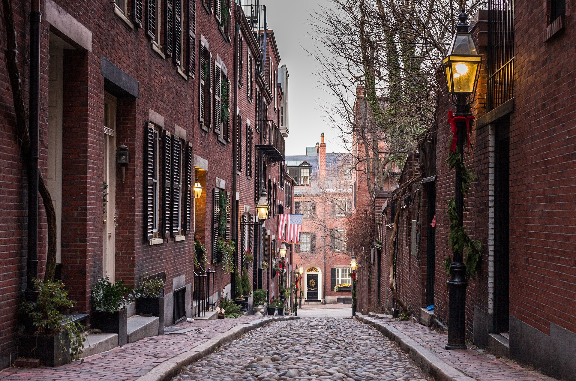
- Acorn Street, the cobblestone lane where coachmen once lived, beautiful with fall leaves.
Stop 4: Boston Common and the Public Garden
Come down the hill to Boston Common, which has been public land since the 1600s and sits on part of the original peninsula. Cross Charles Street into the Public Garden and you step onto made land. The garden sits at the edge of the old Back Bay mudflats, and in October the willows around the lagoon start to turn gold.
The Public Garden is one of my favorite places in the city. It is also why Heritage on the Garden has one of the best addresses in Boston.
Stop 5: Commonwealth Avenue and the Back Bay
Walk west along the Commonwealth Avenue Mall. The Back Bay was once a tidal basin. Filling began in the late 1850s, and trains brought gravel from Needham, about nine miles away, around the clock, with a train arriving every 45 minutes. The Back Bay as we know it was filled by 1882.
The plan was strongly influenced by Haussmann’s Paris, with wide, tree-lined avenues and cross streets named in alphabetical order, from Arlington to Hereford. Count them as you walk.

Stop 6: The Leventhal Map & Education Center
End at the Boston Public Library in Copley Square, itself on Back Bay landfill. The Leventhal Map & Education Center is showing Becoming Boston: Eight Moments in the Geography of a Changing City through February 1, 2027. After a walk like this one, seeing the original maps is the perfect finish.
Tips for Your Historic Boston Walking Tour
- Distance: about three miles. Allow half a day with stops.
- Timing: go on a weekday morning in October, when the light is soft and the Freedom Trail is quieter.
- Shoes: Beacon Hill is all brick and cobblestone, so wear flat, comfortable shoes.
- Where to stay: for a weekend, Mandarin Oriental Boston on Boylston Street puts you a few blocks from the end of the route.
For more ideas, see my list of iconic places to visit in 2026. For me, the best historic Boston walking tour is the one where you keep looking down at the ground and wondering what used to be there.
Leave a Reply